A driveway gate that stops halfway is one of the most common calls HeroTec takes across Canoga Park, and it is also one of the most misread by homeowners. The gate was closing fine yesterday, and today it travels a few feet and halts, or it opens partway and refuses to go further. The instinct is to blame the gate panel, the big visible part, but the panel is rarely the problem. A gate that stops partway is almost always a message from the operator, the sensors, or the track, and reading that message correctly is the difference between a repair that lasts and a reset that fails again by the weekend.
What Stopping Halfway Is Telling You
An automatic gate runs through a cycle every time it opens or closes, and a stop partway means the cycle was interrupted at a specific point. The point matters. A gate that stops at the same spot every time is usually hitting a physical problem there, a binding roller, a dragging hinge, or debris in a sliding gate's track at that position. A gate that stops at random points is more often electronic, a failing motor losing torque mid-travel, a control board fault, or a safety sensor seeing something that is not there. A technician who watches the gate run reads which pattern it follows, because the pattern narrows the cause before a single part is touched.
This is why a phone diagnosis is unreliable and an on-site look is worth the visit. The same symptom, a gate stopping halfway, can come from a dozen causes across the operator, the sensors, the track, and the control board, and the fix for one is nothing like the fix for another. A stocked truck matters here, because once the cause is found, the common parts to correct it, motors, sensors, control boards, are on board for a first-visit repair rather than a second trip.
The Safety Sensors: The Usual Suspect
The most frequent reason a gate stops partway is its safety sensors, the photo-eyes that watch the gate's path. Under UL 325, the automated gate safety standard, a driveway gate has to detect an obstruction and stop or reverse, and the photo-eyes are what do that watching. When a photo-eye is knocked out of alignment, dirtied by Valley dust, degraded by years of west-facing sun, or has a lens clouded by sprinkler overspray, it can read an obstruction that is not there and halt the gate mid-cycle. The gate is doing exactly what the safety standard demands, stopping for a perceived obstacle, but the obstacle is a failing sensor rather than a real object.
In Canoga Park, the environment works hard on these sensors. West-facing sun degrades photo-eye lenses over time, Santa Ana winds blow grit across them, and irrigation overspray leaves mineral film and rust on the housings. A repair that realigns or replaces the sensors restores both the gate's movement and its safety function, which matters because California Health and Safety Code sections 19890 through 19892 require the auto-reverse that those sensors enable. A gate that moves but does not sense is a repair only half done.
The Operator and Motor
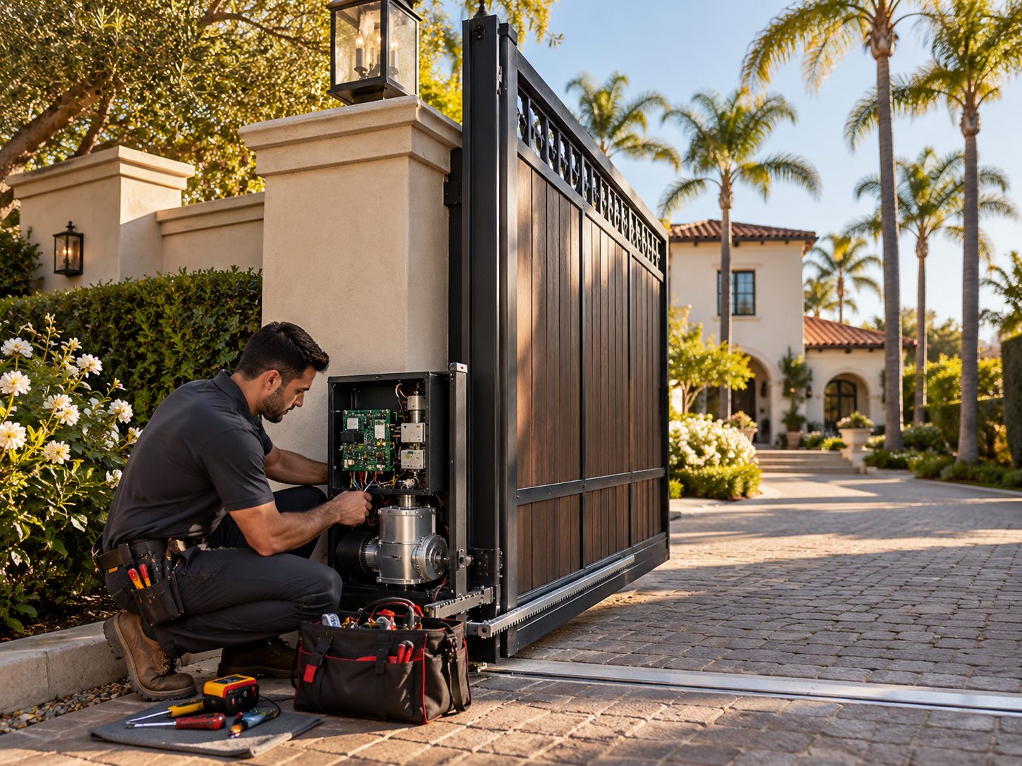
When the sensors check out, the operator is the next place to look. The operator is the powered unit that drives the gate, a swing operator with an arm or articulated linkage on a swing gate, or a sliding operator driving a rack on a sliding gate. Inside it, a motor and a control board manage the cycle. A motor that is wearing out can start a gate moving and then lose the torque to finish, stopping it partway, especially on the heavier pull of opening against a slight grade or a stiff hinge. A control board fault can cut the cycle short or misread a limit. These are the parts that fail with age and use, and they are the parts HeroTec stocks for first-visit repair.
Gate operators are rated in duty cycles, the number of open-and-close cycles they are built to handle, and a busy Canoga Park driveway gate can run through many cycles a day. Over years, that use wears the motor and the moving parts inside the operator. HeroTec's technicians are factory-certified on LiftMaster, DoorKing, and Viking operators, the systems common on Valley driveways, which means a repair works with the operator as the manufacturer designed it rather than guessing at an unfamiliar unit.
The Track, Rollers, and Hinges
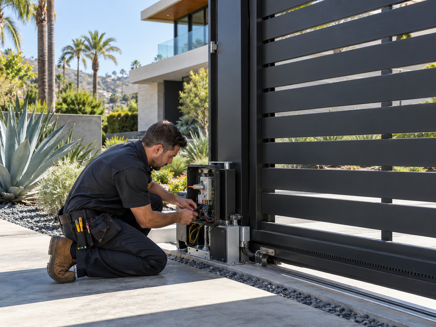
Mechanical binding is the third common cause, and it is the one most tied to the Canoga Park environment. A sliding gate rides on rollers along a track or a cantilever V-track, and that path collects the dust and grit that Santa Ana winds carry. Debris in the track, a worn roller, or a bent track section makes the gate bind at a specific point, and the operator stops rather than forcing through. A swing gate relies on its hinges, and a hinge that has rusted from sprinkler overspray or worn from years of cycling can drag enough to stall the gate. These are physical problems with physical fixes, cleaning and realigning the track, replacing a roller, welding or replacing a hinge.
Welding is part of this work more often than homeowners expect. A hinge that has failed, a bracket that has cracked, or a post that has shifted may need MIG or TIG welding to correct, and HeroTec does that fabrication in the field with custom brackets where a gate needs them. A sliding gate that binds because its track has shifted is a different repair than one that binds because a roller is worn, and telling them apart is part of reading the gate on site.
Why the Rodents Matter
One cause surprises homeowners: rodents. A gate operator and its wiring sit in a box near the ground, often near landscaping, and rodents chew wiring. A gate that stops partway, behaves erratically, or loses a function entirely can trace to a chewed wire or a damaged connection inside the operator housing. It is a common enough problem in the Valley that a technician checks the wiring as part of diagnosing an electronic fault, because a chewed low-voltage line to a sensor or a control board produces symptoms that look like a failing board until the actual wire is found.
This is one more reason the on-site diagnosis matters. A chewed wire and a failing control board can present the same way, a gate stopping partway, and only a look inside the operator tells them apart. Correcting the wire is a far smaller repair than replacing a board, and a technician who finds the real cause saves the homeowner from paying for the wrong part.
Why a Stuck Gate Is Worth a Fast Call
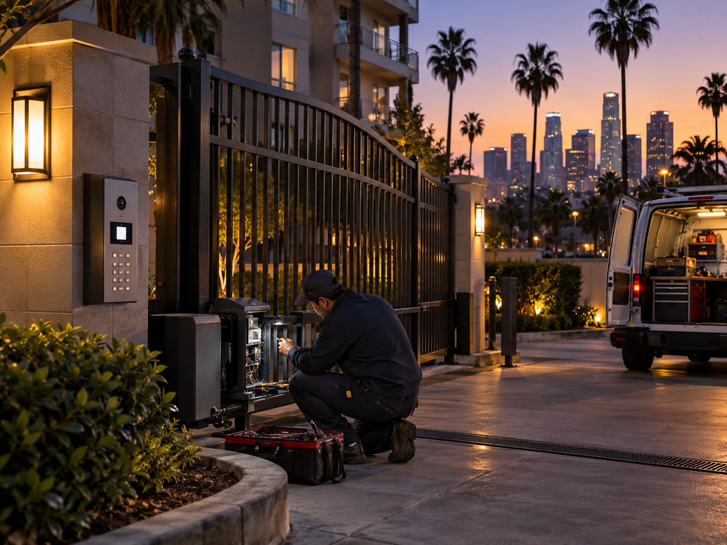
A driveway gate that stops halfway is more than an inconvenience; it is a security and access problem. A gate stuck open leaves a property unsecured, which matters for a home or an HOA community like Elkwood Terrace or Roscoe Courts where the gate is the first line of access control. A gate stuck closed can block a driveway, trapping vehicles in or out, which becomes urgent when someone needs to leave. Because these failures do not keep business hours, HeroTec is open 24/7 with emergency dispatch in roughly 30 to 60 minutes, so a gate that fails on a weekend night or before a morning commute gets attention rather than waiting.
Speed also limits the damage. A gate forced or left straining against a bind can wear its operator faster, and a sensor fault left unaddressed can leave the safety function compromised in the meantime. Catching the cause early, while it is a single worn part, keeps the repair small and keeps the gate both moving and safe.
How the Repair Gets Done Right
A HeroTec repair on a Canoga Park driveway gate follows the diagnosis rather than a script. The technician watches the gate cycle, reads where and how it stops, checks the sensors, the operator, the track, and the wiring, and finds the cause before quoting. The flat-rate, upfront price comes in a written quote before any work begins, so the homeowner knows the cost with no hidden fees. Stocked trucks carry common motors, sensors, and control boards, so most repairs finish on the first visit. The work is backed by a 1-year workmanship warranty on parts and labor, and the technician tests the photo-eyes, reversing action, and gap clearances to UL 325 and ASTM F2200 before leaving, so the gate is restored to code, not just to motion.
A 48-hour follow-up after the repair confirms the gate is running as it should. For homeowners weighing a larger project, Get Now Pay Later financing is available, though a gate repair is quoted at a flat rate rather than a set price. The point throughout is a repair that addresses the real cause and leaves the gate safe, which is a different standard than a quick reset that gets the gate moving until the same fault returns.
Getting a Canoga Park Driveway Gate Moving Again
Swing Gates and Sliding Gates Fail Differently
The type of gate shapes both the failure and the repair, and a technician reads it accordingly. A swing gate opens on an arm or an articulated operator, and when it stops partway the usual suspects are a dragging hinge, a worn operator arm, or a motor losing torque against the weight of the leaf. A sliding gate runs along a track or a cantilever V-track, and a mid-travel stop more often means a roller worn, a track fouled with Valley grit, or a rack-and-pinion issue where the operator meets the gate. Knowing which design is on the property narrows the diagnosis before the operator cover even comes off, which is part of why a gate specialist reads a gate faster than a generalist.
Both designs share the operator, the sensors, and the access control, so many faults cross between them, but the mechanical half is distinct. A cantilever sliding gate, common on wider Canoga Park driveways, carries its own weight on rollers with no bottom track, and a worn cantilever roller fails in a way a swing hinge never does. HeroTec repairs both, and the stocked trucks carry the parts each uses, so a swing operator arm or a cantilever roller can be corrected on the first visit rather than ordered after a diagnosis.
The habit worth keeping as a Canoga Park gate owner is to treat the first sign of trouble, a gate that hesitates, stops short, or sounds different, as a reason to call rather than a quirk to live with. A gate that is pushed to keep working through a developing fault wears its operator and its parts faster and can lose its safety function in the meantime. Catching the cause early, while it is a single sensor, roller, or wire, keeps the repair small, keeps the gate safe, and keeps a minor fault from becoming the dead gate that leaves a property unsecured on a weekend night, which is the outcome a quick call avoids and a long wait invites, and the reason a gate that acts up is worth attention the same week rather than the same season.
A driveway gate that stops halfway is sending a specific signal, and reading it correctly is what separates a lasting repair from a temporary one. Homeowners, property managers, and HOA boards across Canoga Park and the West San Fernando Valley can reach HeroTec Inc.around the clock for driveway gate repair, with 30 to 60 minute emergency dispatch, flat-rate upfront pricing, and a first-visit fix where the part is on the truck. To get a stuck gate diagnosed and repaired, call (747) 350-2192 or visit herotecinc.com/locations/canoga-park-driveway-gate-repair.
UL 325 Requires Gates to Reverse on Contact
UL 325 is the safety standard for automated gate operators, and it requires entrapment protection such as photo-eyes or reversing edges that stop or reverse a gate when something is in its path. A gate that does not reverse on contact is out of compliance and a safety risk, not just an inconvenience.
California Law Sets an Auto-Reverse and Timer Rule
California Health and Safety Code sections 19890 through 19892 require automatic gates to auto-reverse on an obstruction and to close within about 30 seconds. These rules exist because gate entrapment has caused serious injuries, which is why a repair should restore the safety function, not just the movement.
Most Gate Faults Trace to Sensors or the Operator
A large share of driveway gate failures come down to the safety sensors or the operator rather than the gate panel itself. Photo-eyes knocked out of alignment, a failing motor, or a control board fault stop a gate partway far more often than a problem with the gate's frame.
Canoga Park is a neighborhood in the city of Los Angeles, California, located in the San Fernando Valley. Before the Mexican–American War, the neighborhood was part of a rancho, and after the American victory it was converted into wheat farms and then subdivided, with part of it named Owensmouth as a town founded in 1912. It was annexed by Los Angeles in 1917 and was renamed Canoga Park on March 1, 1931, after Canoga, New York.[2]
In 1863, the syndicate San Fernando Homestead Association led by Isaac Lankershim and Isaac Van Nuys purchased the southern half of the historic San Fernando Valley. They established seven wheat ranch operations and were the first to ship wheat to Europe from California. In 1869, Alfred Workman acquired the westernmost ranch, a 13,000 acres (50 km2) wheat farm in future Canoga Park (for more: See Landmarks section below).[11] Eucalyptus trees were introduced into the San Fernando Valley by Albert Workman, who imported seedlings from his native Australia and planted them on the Workman Ranch. In time, they spread through the Canoga Park area ranches, farms and beyond. It has been said that these trees are the parents of all eucalyptus trees in Southern California.[12][13]
1920 Sherman Way in downtown Owensmouth, with Los Angeles Pacific Railroad lines visible at right
The area was originally named Owensmouth by Los Angeles Suburban Home Company by general manager Hobart Johnstone Whitley as a sales tactic in that the town would be the new mouth of the Owens River, after the Los Angeles Aqueduct would be completed the next year. The town was founded on March 30, 1912, and the Suburban Home Company contracted with the Janss Investment Company, to sell properties. A pre-development scheme brought Pacific Electric streetcars and an all purpose highway (Sherman Way) out all the way from Hollywood through Cahuenga Pass, through the previously subdivided Van Nuys (1911). Highlighting the "opening day barbecue" was the display of the "Owensmouth Baby", a racecar that could go up and down the paved Sherman Way at the incredible speed of 35 mph.
A sign for Canoga Park's old town center on Sherman Way
Owensmouth, as the junior San Fernando Valley city to Van Nuys, promoted itself with the "baby" motif—using storks in their advertisement. The "baby city" of the Valley remained a very small community.
The lack of an independent water supply made annexation to the City of Los Angeles inevitable, and on February 26, 1917, it joined with its larger neighbor. The name was changed to Canoga Park in 1931, thanks to the efforts of local civic leader Mary Logan Orcutt.[14] Eventually, the area's zoning was rural/agricultural and its industry was small farms involved in the production of fruits, vegetables, and melons, some livestock, horses, a movie/television studio, and a stunt location.[15]
The Canoga Park Airstrip occupied the area now known as "Warner Center" (as shown on the street map 1955 Thomas Guide).
Canoga Park has hosted a Memorial Day Parade for over three decades. The parade is organized by local representatives from the Canoga Park Community Center and local business leaders. It pays tribute to fallen servicemen and women from all branches of the U.S. Armed Forces. A flyover by the Condor Squadron serves as the kickoff of the parade. A special ceremony for fallen heroes from Canoga Park High School, including those dating back to World War II is part of the opening presentation.[16] The parade route goes along Sherman Way.
Founded in 2000, the festival celebrated its 25th anniversary in 2025. It is one of the biggest Day of the Dead celebrations in the San Fernando Valley.The festival spans eight city blocks along Sherman Way between Topanga Canyon Blvd. and Canoga Ave and is attended by thousands of people. The festival happens on the first Sunday of November every year. The day long event includes live music, altars, art, food, children's activities, a catrina contest and a classic car show featuring lowriders, motorcycles and low rider bicycles.[17]
In 1955, Rocketdyne, then a division of North American Aviation (NAA), moved into the area and built its main manufacturing facility in Canoga Park. The facility became a major employer along with the Atomics International and Santa Susana Field Laboratory (SSFL) divisions of NAA.[18] Other aerospace companies followed: including Thompson Ramo Wooldridge-TRW, Hughes Aircraft, Rockwell International, Boeing, and Teledyne. Small machine shops and other ancillary businesses also sprang up to service the aerospace industry. The Rocketdyne facility was in the end operated by Aerojet Rocketdyne, who moved out of Canoga Park in 2014. Demolition and site clearing of the former Rocketdyne facility in Canoga Park commenced in August 2016.[19][20] The Santa Susana Field Lab property has also been closed[when?] and will be[when?] undergoing an extensive environmental cleanup, and become an open-space park.[21][22]
This article needs to be updated. Please help update this article to reflect recent events or newly available information.(August 2025)
In 1987, much of the western district of Canoga Park was renamed West Hills. On June 25, 2005, Canoga Park was named an All-America City a first for the city of Los Angeles.[23]
The use of toxic chemicals like trichloroethylene and tetrachloroethene as cleaning solvents during production by aerospace and defense contractor companies in their Canoga Park industrial facilities led to groundwater pollution on their sites and across the neighborhood.[24][25][26]
Since 2003, environmental testing on a former Litton Industries, later Northrop Grumman, industrial site revealed unsafe levels of toxic chemicals on the site; 2007 tests further revealed that toxins had spread to an area beyond the site. In 2021, a petition for a class action against Northrop Grumman on behalf of affected residents was filed. The petition sought monetary compensation for losses in property value and called on Northrop Grumman to mitigate the contamination, alleging that the chemicals had leaked from the site and contaminated groundwater under 3,200 properties in an area about 2.4 miles long and 1.8 miles wide and that the corporation failed to properly contain or remediate the damage after it acquired the site in 2001. The corporation argued that they had complied with the California State Water Resources Control Board and that the Board had approved their actions.[24][25]
A June 2024 report on soil vapor and groundwater inspections conducted near the vacant Rocketdyne site, delivered to the California State Water Resources Control Board on behalf of RTX Corporation, reported levels of toxic cleaning solvents that were above levels that could pose a threat to the environment and human health. According to the LA Times in August, several residents of apartments which had been inspected reported that they were not notified of the testing nor of test results.[27] The Water Board confirmed that they were reviewing the report and responded about 7,000 individuals in residences and businesses within 500 feet of the site were notified. The Board also reported that they had notified some 4,000 Canoga Park residents about exposure to toxic chemicals from the former Litton Industries site.[26]
Bell and Dayton Creeks flowing from the Simi Hills, and Arroyo Calabasas (Calabasas Creek) from the Santa Monica Mountains are several of the headwaters of the Los Angeles River that originate in the western San Fernando Valley that flow through Canoga Park. The Los Angeles River itself begins at the confluence of Calabasas Creek and Bell Creek behind Canoga Park High School. These and other small creeks supply storm water and suburban runoff water to the Los Angeles River, and several are considered year round creeks. Although the creeks are now channeled and run within concrete walls, they do form a significant urban wildlife landscape and contribute to the population of indigenous wildlife left within the San Fernando Valley.[28]
This area experiences hot and very dry summers. According to the Köppen Climate Classification system, Canoga Park has a hot-summer Mediterranean climate, abbreviated Csa on climate maps.[29] Precipitation is more common from December to March. Temperatures in the daily high range from 19 °C (66 °F) to 34 °C. Daily low temperatures range from 5 °C (41 °F) to 14 °C.
The 2000 U.S. census counted 53,227 residents in the 4.35-square-mile (11.3 km2) Canoga Park neighborhood—or 12,240 people per square mile, about an average population density for the city. In 2008, the city estimated that the population had increased to 60,578. In 2000, the median age for residents was 30, also about average for city and county neighborhoods.[31]
The neighborhood was considered "highly diverse" ethnically within Los Angeles. The breakdown was 50.9% Latino; 30.7% White; 11.1% Asian; 4.3% Black; and 3.1% other. Mexico (45.8%) and El Salvador (11.6%) were the most common places of birth for the 42.8% of the residents who were born abroad—which was about an average percentage for Los Angeles as a whole.[31]
The median yearly household income in 2008 dollars was $51,601, considered average for the city. Renters occupied 63.6% of the housing stock, and house- or apartment-owners held 36.4%. The average household size of three people was average for Los Angeles. The 18.1% of families headed by single parents was also average for city neighborhoods.[31]
The percentage of residents aged 19 to 34 was among the county's highest, as was the percentage of never-married men (40.4%).[31]
Main Street Canoga Park is the historical designation for downtown Canoga Park along Sherman Way. The area was once known as "Antique Alley" and has a lot of vintage boutiques, coffee shops and art.[32]
Los Angeles Police Department Topanga Community Police Station serves residents in Canoga Park, parts of Winnetka, West Hills, and Woodland Hills. The Topanga Community Police Station opened in January 2009. The police department named the station after a village in the Tongva language of the historically local Tongva-FernandeñoNative Americans tribe. The department originally planned to name it the Northwest Station, but residents preferred a name linking to the town's history.[33] Prior to the opening of the Topanga station, the Devonshire Community Police Station served addresses north of Roscoe Boulevard while the West Valley Police Station served addresses south of Roscoe Boulevard.[34]
Lanark Recreation Center, formerly Orcutt Park, is an LA City park in Canoga Park (21816 Lanark Street and Topanga Canyon Boulevard, 91304). The center has a lighted baseball diamond, an unlighted baseball diamond, lighted indoor basketball courts, lighted outdoor basketball courts, a children's play area, a lighted football field, an indoor gymnasium (without weights), picnic tables, a lighted soccer field, lighted tennis courts, lighted volleyball courts, and an auditorium. It also serves as a Los Angeles Police Department drop-in site.[44]
Lanark Pool, an outdoor unheated seasonal pool, is on the park site.[44][45]
Jimmy Osmond, (b. 1963), singer, businessman, actor, entertainer; the only member of The Osmonds not to have been born on their hometown of Ogden, Utah[54]
^Ogden Hoffman, 1862, Reports of Land Cases Determined in the United States District Court for the Northern District of California, Numa Hubert, San Francisco
Simi Valley's name is derived from the Chumash word Shimiyi, which refers to the stringy, thread-like clouds that typify the region.[13][14][15] The name could have originated from the strands of mist from coastal fog that move into the Oxnard Plain and wind their way up the Calleguas Creek and the Arroyo Las Posas into Simi Valley.[16] The origin of the name was preserved because of the work of the anthropologist John P. Harrington, whose brother, Robert E. Harrington lived in Simi Valley. Robert Harrington later explained the name: "The word Simiji in Indian meant the little white wind clouds so often seen when the wind blows up here and Indians living on the coast, would never venture up here when those wind clouds were in the sky. The word Simiji was constructed by whites to the word Simi. There are other explanations about the name Simi, but this one was given to me by my brother who worked over 40 years for the Smithsonian Institution and it seems most plausible to me".[17][18]
Three Chumash settlements existed in Simi Valley during the Mission period in the late 18th and early 19th century: Shimiyi, Ta'apu (present-day Tapo Canyon), and Kimishax or Quimicas (Happy Camp Canyon west of Moorpark College).[19][20][21] There are many Chumash cave paintings in the area containing pictographs, including the Burro Flats Painted Cave in the Burro Flats area of the Simi Hills, located between the Simi Valley, West Hills, and Bell Canyon. The cave is located on private land owned by NASA. Other areas containing Chumash Native American pictographs in the Simi Hills are by Lake Manor and Chatsworth.[22]
The first Europeans to visit Simi Valley were members of the Spanish Portolá expedition (1769–1770), the first European land entry and exploration of the present-day state of California. The expedition traversed the valley on January 13–14, 1770, traveling from Conejo Valley to San Fernando Valley. They camped near a native village in the valley on the 14th.[23]
Rancho Simí, also known as Rancho San José de Nuestra Señora de Altagracia y Simí,[24] was a 113,009-acre (457 km2) Spanish land grant in eastern Ventura and western Los Angeles counties granted in 1795 to Santiago Pico. After Santiago Pico's death in 1815, the Rancho was regranted to Santiago's sons Javier Pico and his two brothers, Patricio Pico and Miguel Pico, members of the prominent Pico family of California.[24]Rancho Simí was the earliest Spanish colonial land grant within Ventura and Santa Barbara Counties. The name derives from Shimiji, the name of the Chumash Native American village here before the Spanish.[25] It was the largest Spanish or Mexican land grant given in Ventura County, and one of the largest given in California. The Simi Adobe-Strathearn House, later the home of Robert P. Strathearn and family, served as the headquarters of the rancho.
José de la Guerra y Noriega, a Captain of the Santa Barbara Presidio, who had begun to acquire large amounts of land in California to raise cattle, purchased Rancho Simí from the Pico family in 1842. After Jose de la Guerra death in 1858, the sons of Jose de la Guerra continued to operate the ranchos. The end of their prosperity came when several years of drought in the 1860s caused heavy losses. In 1865, the De la Guerras lost the ownership of El Rancho Simí excluding the Rancho Tapo. El Rancho Tapo was part of the original 113,009-acre Rancho Simí grant, but sometime around 1820–1830, the Rancho Tapo came to be thought of as a separate place within Rancho Simí.[24] The last of the De la Guerras to live in Simí Valley retreated to a 14,400-acre portion of the original rancho that was known as the Tapo Rancho. As late as February 1877, Juan De la Guerra was reported in county newspapers to be preparing to plant walnuts in the Tapo, which appears to be the final mention of their farming in relation to the original Simí grant.
The De la Guerra heirs tried every legal means, but by the 1880s, the Rancho Tapo also slipped from their ownership, as had the rest of the Rancho.[24]
The Pioneer, or 'American,' period in Simi Valley began with the 96,000-acre purchase of El Rancho Simí by an eastern speculator named Thomas A. Scott (1814–1882), who had made his money as an investor in the Pennsylvania Railroad during the Civil War. He was president of the Pennsylvania Railroad, and a partner in Philadelphia and California Petroleum Company. Scouts came to California to purchase lands, and thus Scott acquired El Rancho Simí (1865). His goal was to locate sites for oil, since the first oil well had been developed in Titusville, Pennsylvania just a few years earlier (1859). Within a short time, a 27-year-old man named Thomas Bard was sent west by Scott to manage the California properties. In the late 1880s, Simí Land and Water Company was formed to see to the selling of the huge rancho in ranch-size properties. Some American farmers had begun to lease land in the greater Rancho Simí for farming.[24][26]
The earliest Anglo American ranchers showed up in Simí Valley in the late 1860s into the 1870s. Charles Emerson Hoar was given the title of "first American farmer" by early Simí historian Janet Scott Cameron. He had purchased the Hummingbird's Nest Ranch in the northeast corner of the Valley, and he leased land from the new owners of the Simí Rancho for raising sheep, already a proven way of making a living.
Much of the Simí Rancho land continued, as in Spanish days, to be used for raising sheep, cattle and grain. Wheat was more likely to prosper here than in the rest of the county, being free of wheat leaf rust, a fungal disease. Barley soon became the predominant grain crop.
Agriculture and ranching dominated the landscape through the 1950s. Citrus, walnuts and apricots were all grown in Simi Valley. In the early 1960s modern residential development began to take place.
Prior to modern residential development, Simí was an agricultural community, with ranch houses dotting the valley. 1957 and 1958 brought the first 'tract' housing developments when the Dennis and Ayhens, Wright Ranch and Valley Vista tracts were built, a rapid increase in residential development took place beginning in 1960. The population which was 4,073 in 1950[27] doubled to 8,110 in 1960.[28] By 1970 the population in Simi is reported by the census as 59,832.
Four communities prior to modern residential development
The pioneers arrived in the late 1860s – 1870s and ever since, this has been 'The Valley of Simi.' But, not all the communities in the valley were known as 'Simi.' There was the township of Simi (known as 'Simiopolis' for about a six-month period in 1888). In the valley there were also the communities of Santa Susana, Community Center and the Susana Knolls (known first as Mortimer Park) at different points in time.
Simi – In late 1887–1888, the incorporation of Simi Land and Water Company came about. El Rancho Simí was divided into ranches and farms by that corporation, and advertised for sale to midwestern and New England states. An investor group, the California Mutual Benefit Colony of Chicago, purchased land and laid out a townsite (located between First and Fifth Streets and from Los Angeles south to Ventura Ave), named it 'Simiopolis' and shipped twelve pre-cut, partially assembled houses from a lumberyard in Chicago via rail to Saticoy, then brought by wagon to Simi. These are known as 'colony houses.' This was the first 'neighborhood' in Simi. Stores sprung up on Los Angeles Ave, and the first Simi School was built in 1890 on Third and California Streets, and was used until Simi Elementary was built in the mid-1920s.
Santa Susana – In 1903 the Santa Susana Train Depot was built, and the railroad was complete through Simi Valley, except for the tunnel, which was completed in 1904. A small business community grew up near the Santa Susana Train Depot, which was located on the north side of Los Angeles Ave, just east of Tapo Street. Over time residential developments followed and the town of Santa Susana was born. The Depot was moved in 1975 by Rancho Simi Recreation and Park District to its current location off of Kuehner.
Community Center – In 1922 L.F. Roussey laid out the small development which became known as Community Center. The driving force behind this development was the need for a High School in Simi Valley, as well as an elementary school in a more central location in the valley. The first graduating class from Simi High School was 1924, Simi Elementary was completed in 1926, The Methodist Church (which is now the Cultural Arts Center) was built in 1924. Numerous houses were built in Community Center in the 1920s and 1930s. The Simi Valley Woman's Club was located there as well (the building which served as the clubhouse for the Woman's Club was moved from the town of Simi). The Woman's Club club house was used by many individuals and organizations as a community meeting place.
Mortimer Park (the Susana knolls) – The area that is now the Knolls was a nearly 1,800-acre parcel of land (730 ha) that was purchased by Mr. and Mrs. Lewis T. Mortimer in the early 1920s. They planned on selling the lots for cabins, or vacation homes. The lots were very small (30 x 50 feet), and the Mortimers did not take the mountainous nature of the land into account, so quite often the lots were not buildable. Oftentimes several lots were needed to build structures. In 1944 the Garden Club, an active community organization in the area petitioned the county supervisors to change the name of Mortimer Park to the Susana Knolls.
The first attempt to incorporate the towns of Simi, the area known as Community Center (93065) and Santa Susana (93063) in 1966 was unsuccessful. The second attempt in 1969 was successful, with residents voting 6,454 to 3,685 in favor of incorporation. 59% of eligible voters turned out for this vote. Susana Knolls is an unincorporated area of the Valley. Voters also voted whether to call this newly incorporated city 'Santa Susana' or 'Simi Valley.' The name Simi Valley garnered 2,000 more votes than Santa Susana.[29]
The 2,848 acres (1,153 ha) Santa Susana Field Laboratory located in the Simi Hills, was used for the development of pioneering nuclear reactors and rocket engines beginning in 1948. The site was operated by Atomics International and Rocketdyne (originally both divisions of the North American Aviation company). The Rocketdyne division developed a variety of liquid rocket engines. Rocket engine tests were frequently heard in Simi Valley. The Atomics International division of North American Aviation designed, built and operated the Sodium Reactor Experiment, which in 1957 became the first United States commercial nuclear reactor to supply electricity to a public power system,[30] when it powered the city of Moorpark (the government owned BORAX-III reactor had previously powered Arco, Idaho for around an hour in 1955). The last nuclear reactor operated at SSFL in 1980 and the last rocket engine was produced in 2006. The SSFL has been closed to development and testing. The site is undergoing investigation and removal of the nuclear facilities and cleanup of the soil and groundwater. The Boeing Company, the US DOE, and NASA are responsible for the cleanup.[31][32]
In July 1959, the Sodium Reactor Experiment suffered a serious incident when 13 of the reactor's 43 fuel elements partially melted resulting in the controlled release of radioactive gas to the atmosphere. The reactor was repaired and returned to operation in September 1960. The incident at the Sodium Reactor Experiment has been a source of controversy in the community. Technical analysis of the incident intended to support a lawsuit against the current landowner (The Boeing Company) asserts the incident caused the much greater release of radioactivity than the accident at Three Mile Island.[33] Boeing's technical response concludes the monitoring conducted at the time of the incident, shows only the allowable amount of radioactive gasses were released, and a Three Mile Island-scale release was not possible.[34] The case was settled, it is reported, with a large payment by Boeing. In September 2009, The U.S. Department of Energy sponsored a public workshop where three nuclear reactor experts shared their independent analysis of the July 1959 incident.[35]
Simi Valley is a city located in the very southeast corner of Ventura County, bordering the San Fernando Valley in Los Angeles County, and is a part of the Greater Los Angeles Area. The city of Simi Valley primarily consists of the eponymous valley itself.[37] The city of Simi Valley borders the Santa Susana Mountains to the north, the Simi Hills to the east and south, and is adjacent to Thousand Oaks to the southwest and Moorpark to the west. Simi Valley is connected to the nearby San Fernando Valley by the Santa Susana Pass in the extreme east of Simi Valley. The syncline[38] Simi Valley is located in the western part of the region called the Transverse Ranges.[39] While the Santa Susana Mountains separate the valley from the Los Padres National Forest in the north, the Simi Hills separate it from Conejo Valley in the south. In the extreme east is Rocky Peak, one of Santa Susana Mountains' highest peaks, which is a dividing line between Ventura County to the west and Los Angeles County to the east. On the other side of the valley, in the extreme west side of Simi Valley is Mount McCoy, which may be most known for its 12 ft. concrete cross that sits at its peak. The physiographical valley is a structural as well as a topographic depression.[40] The Simi Valley, just as neighboring San Fernando Valley, owes its existence and shape to the faulting and folding of the rocks. It is essentially a structural valley and not wholly the work of erosion.[41] It is drained by the Calleguas Creek and also its principal tributary, Conejo Creek. Both of these originate in the Santa Susana Mountains.
According to the United States Census Bureau, the city has a total area of 42.2 sq mi (109.4 km2), comprising 41.5 sq mi (107.4 km2) of land and 0.77 sq mi (2.0 km2), or 1.81%, of it is water. Simi Valley is located northwest of the Los Angeles neighborhood of Chatsworth and approximately 30 mi (50 km) from Downtown Los Angeles, 380 mi (610 km) south of San Francisco, 160 mi (260 km) north of San Diego, and 350 mi (560 km) south of Sacramento. Commutes to Los Angeles are usually via the State Route 118 (Ronald Reagan Freeway) or the Southern California Metrolink commuter train, which makes several daily trips from Simi Valley. Simi Valley has a mediterranean climate. Temperate variations between day and night tend to be relatively big. The mean annual temperature is 64.1 degrees (17.8 °C), while the annual precipitation is 18.39 inches (467 mm). The precipitation remains less than one inch for seven months – April until October, – while the precipitation exceeds four inches in the two wettest months – January and February. While the mean temperature is at its lowest at 53.6 degrees (12.0 °C) in December, the mean temperature in July and August exceeds 76 degrees (24 °C).[42]
Simi Valley has been the victim of several natural disasters, including the flood of 1967, the storm of 1983, the 1988 lightning strike, as well as the 1994 Northridge earthquake and numerous wildfires.[29]
Simi Valley has a warm and dry climate during summer when mean temperatures tend to be in the 70s °F (low 20s °C). The city's climate cools during winter when mean temperatures tend to be in the 50s °F (low 10s °C). Because of its relatively low elevation, the Simi Hills typically experience rainy, mild winters. Snow is rare in the Simi Hills, even in the highest areas. The warmest month of the year is August with an average maximum temperature of 96 °F (36 °C), while the coldest month of the year is December with an average minimum temperature of 38 °F (3 °C). Temperature variations between night and day tend to be relatively large during summer, with a difference that can reach 38 °F (21 °C), and moderate during winter with an average difference of 29 °F (16 °C).
The annual average precipitation in Simi Valley is 17.9 inches (450 mm). Winter months tend to be wetter than summer months. The wettest month of the year is February with an average rainfall of 4.8 inches (120 mm). Simi Valley gets 18 inches (460 mm) of rain per year, while the United States average is 37. Snowfall is 0 inches (0 mm), while the U.S. average is 25 inches (640 mm) of snow per year. The number of days with measurable precipitation is 25. On average, there are 277 sunny days in Simi Valley per year. The July high is approximately 96 °F (36 °C). The January low is 39 °F (4 °C).[43] The record low is 18 degrees Fahrenheit (−8 °C) (recorded in February 1989)[44] and the record high is 116 degrees Fahrenheit (47 °C) (recorded in August 1985).[44]
Wildfire in the Simi Hills, 2003. U.S. Air Force C-130 Hercules pilots flew eight C-130 cargo airplanes and dropped 129,600 gallons of retardant on the fire.
An aspect of Simi Valley's location, situated beside the Simi Hills, is that it lies in a high-risk area for the wildfires that sweep through Southern California's mountain ranges every few years. Simi Valley is also at risk for earthquakes. The valley is surrounded by faults; the closest ones being the Santa Rosa Fault to the Northwest, the Northridge Hills Fault to the Northeast, and the Chatsworth Fault to the South. In 1994, portions of Simi Valley received significant damage from the Northridge earthquake.[46]
In autumn 2003, the Simi Fire burned about 108,000 acres (440 km2). A 2005 fire started on September 28 and burned an estimated 7,000 acres (30 km2). On September 29, the fire was estimated to be 17,000 acres (70 km2). More than 1,000 firefighters worked against the tricky combination of dry brush, low humidity and temperatures in the high 90s °F (high 30s °C) along the line that divides Los Angeles and Ventura counties. The fire was later brought under control and extinguished, without serious injury. Three homes were lost in outlying areas, but none within the city limits.
Downtown/Los Angeles Avenue Corridor - The Envision Simi Valley Specific Plan [48][49] was created to provide a framework for mixed-use development to turn this portion of the city into a walkable area where people work and live.
Santa Susana - A portion of this neighborhood was included in the Envision Simi Valley Specific Plan, to create a framework for redevelopment into a secondary, smaller downtown.[49]
Simi Valley, California – Racial and Ethnic Composition Note: the US Census treats Hispanic/Latino as an ethnic category. This table excludes Latinos from the racial categories and assigns them to a separate category. Hispanics/Latinos may be of any race.
Before the 1960s, Simi Valley once boasted a strong community of Latino families, many of whom worked for white ranchers. However, the housing boom in the 1960s and 1970s attracted many white Americans leaving urban areas in Los Angeles and the San Fernando Valley.[61] This turned Simi Valley into a predominately white city, but the percentage of those who identified as non-Hispanic white began to decrease from 86.2% in 1980 to 54% in 2020.
The Census reported that 123,577 people (99.5% of the population) lived in households, 482 (0.4%) lived in non-institutionalized group quarters, and 178 (0.1%) were institutionalized. There were 41,237 households, out of which 16,765 (40.7%) had children under the age of 18 living in them, 24,824 (60.2%) were opposite-sex married couples living together, 4,659 (11.3%) had a female householder with no husband present, 2,214 (5.4%) had a male householder with no wife present. There were 1,975 (4.8%) unmarried opposite-sex partnerships, and 291 (0.7%) same-sex married couples or partnerships. A total of 7,087 households (17.2%) were made up of individuals, and 3,013 (7.3%) had someone living alone who was 65 years of age or older. The average household size was 3.00. There were 31,697 families (76.9% of all households); the average family size was 3.33.
The population was spread out, with 31,036 people (25.0%) under the age of 18, 11,088 people (8.9%) aged 18 to 24, 33,890 people (27.3%) aged 25 to 44, 35,046 people (28.2%) aged 45 to 64, and 13,177 people (10.6%) who were 65 years of age or older. The median age was 37.8 years. For every 100 females, there were 96.6 males. For every 100 females age 18 and over, there were 94.4 males. There were 42,506 housing units at an average density of 1,006.1 per square mile (388.5/km2), of which 30,560 (74.1%) were owner-occupied, and 10,677 (25.9%) were occupied by renters. The homeowner vacancy rate was 1.2%; the rental vacancy rate was 4.6%. 93,181 people (75.0% of the population) lived in owner-occupied housing units and 30,396 people (24.5%) lived in rental housing units.
As of the 2000 United States census,[64] there were 111,351 people, 36,421 households, and 28,954 families residing in the city. The population density was 1,097.3/km² (2,841.9/mi²). There were 37,272 housing units at an average density of 367.3/km² (951.3/mi²). The racial makeup of the city was 81.33% White, 1.26% Black or African American, 0.70% Native American, 6.33% Asian, 0.14% Pacific Islander, 6.50% from other races, and 3.74% from two or more races. 16.82% of the population were Hispanic or Latino of any race.
There were 36,421 households, out of which 42.5% had children under the age of 18 living with them, 63.9% were married couples living together, 10.7% had a female householder with no husband present, and 20.5% were non-families. 14.7% of all households were made up of individuals, and 4.9% had someone living alone who was 65 years of age or older. The average household size was 3.04 and the average family size was 3.33.
In the city, the population was spread out, with 28.4% under the age of 18, 7.9% from 18 to 24, 32.9% from 25 to 44, 23.1% from 45 to 64, and 7.6% who were 65 years of age or older. The median age was 35 years. For every 100 females, there were 97.9 males. For every 100 females age 18 and over, there were 95.6 males.
According to a 2022 estimate, the median income for a household in the city was $112,144.[65] 7.02% of the population and 7.4% of families were below the poverty line. In 2022, the median income for a household in Simi Valley has increased to $112,114 according to the U.S. Census Bureau. The median per capita income for the past 12 months (2021) was $51,324.[66] Sales tax was at 7.25% and income taxes were at 8.00%. The current unemployment rate was at 4.10% with a 0..46% recent job growth compared to the National Unemployment Rate of 5.20% and a 1.59% job growth.[67] The median cost of homes in Simi Valley was $704,200 with mortgages at a median of $3,047.[66]
Commuting to Los Angeles for work is done by 27% of Simi Valley residents, with 20% working within Simi Valley.[68]
The primary industry is machinery and tools with 69 firms, and the secondary is the metal industry with 51 firms. Other industries include lumber/wood products, food, plastic products, apparel/textiles and minerals.[69]
A division of Countrywide Financial had been partially headquartered in the city from the mid-1990s into 2008.[70][71] In 2008 Countrywide Financial was bought out by Bank of America.[72]
The Ronald Reagan Presidential Library, located in Simi Valley, was visited by almost 400,000 people in 2014.[75] After the death and state funeral of Ronald Reagan, the former US president was buried at the library in June 2004. The library adjoins a hangar in which the Boeing 707 SAM 27000 (Air Force One), which served presidents Nixon through G.W. Bush, is housed and available for tours. In the pavilion are various automobiles used to transport the president, as well as Marine One, the presidential helicopter.
The Simi Valley Public Library opened in 1916, and moved to its current building on February 24, 1980.[76][77]
View of Bard Lake from the Sunset Hills TrailMayfair Park in Simi Valley in November, 2022[78]
Simi Valley has 5,600 acres (2,300 ha) of public owned land,[79][80] including hundreds of acres of land in the Simi Hills.[81] Simi Valley has forty-two community parks and one community pool that are open to the public and maintained by the Rancho Simi Recreation and Parks District.[82][83]
Simi Valley's government uses the "council-manager" form of government.[88] This means that the city council is composed of one mayor, elected every two years, and four council members elected for four-year terms. The city council appoints both the city attorney and city manager, who heads the executive branch of the city government. The city manager appoints the various department heads for the city, and acts as the city clerk and city treasurer.
According to the 2008–2009 Comprehensive Annual Financial Report Fund Financial Statements, the city's various funds had $89.3 million in Revenues, $86.3 million in expenditures, $139.9 million in total assets, $26.1 million in total liabilities, and $158.5 million in investments.[89]
As of the 2024 General Election results, all of Simi Valley's elected representatives are from the Democratic Party.[111][112][113]
In November 2018, Katie Hill unseated Republican Steve Knight and became the first Democratic woman to represent the district in the House of Representatives. Additionally, in 2022, Alex Padilla became the first Latino elected to the Senate from California.[114]
The Montalvo Cutoff, a railroad line opened by the Southern Pacific Railroad on March 20, 1904, to improve the alignment of its Coast Line, runs east–west through the valley.[115] In 1905, the longest train tunnel in the United States at that time was completed at the east end of Simi Valley. Tunnel #26 is still being used linking Simi Valley and the San Fernando Valley through the Santa Susana Mountains.[116][117][118] The area was originally served by the Santa Susana Depot which was also opened in 1904 as a combination passenger and freight depot built by the Southern Pacific and located on Los Angeles Avenue near Tapo Street. The station remained in use for the 60 years.[citation needed]
Simi Valley and the surrounding hills have been the site of several television shows, including the long-running series Gunsmoke and M*A*S*H.
Established in 1937 and opened to the public in 1949, the Corriganville Movie Ranch, established by Ray "Crash" Corrigan, is located at the extreme Eastern end of Simi Valley and was the production site for many movies and television shows. Today the site is open to the public as Corriganville Park, just off the Santa Susana Pass Road.
The popular 1970s television show Little House on the Prairie utilized an expansive collection of sets constructed throughout the hilly landscapes of Big Sky Ranch in the Tapo Canyon hills north of Simi Valley and Santa Clarita, California. In addition to the Little House itself, the entire set for the town of Walnut Grove was built atop the hills. After finishing his work on the series, Michael Landon blew up the town (which became part of the final movie)[121] but the Little House itself was left intact. In July 2004, the house was destroyed by a devastating California wildfire.[122]
The 1973 film The Doberman Gang was filmed entirely in Simi Valley, with the actual Bank of A. Levy as the backdrop for the robbery scenes.
In 1983, Colleen McCullough's TV mini-series The Thorn Birds was brought to life in a remote corner of the Simi Valley. Australia presented too many hurdles for producers, the least of which was the restriction that only two American actors star in any movie filmed there; the rest had to be Australian. Location scouts went scouring, and Simi Valley, some of which strongly resembles parts of the Australian countryside, was chosen for the famous Cleary ranch and sheep station, Drogheda.[citation needed]
In the 1984 film Bachelor Party starring Tom Hanks, the MANN 6 Movie Theater, formerly located within the Sycamore Shopping Center, was used for the movie theater scene.
The 1986 western comedy film Three Amigos was partially filmed here.
The 1982 hit horror film Poltergeist was filmed on Roxbury Street in Simi Valley. At the time, the homes were new and the land behind the street was free, allowing plenty of access for studio trucks. 4267 Roxbury Street (the Freeling house in the film) suffered substantial earthquake damage in the 1994 Northridge earthquake.
For the 1992 movie Sneakers with Robert Redford, the Gibraltar Savings building (later Countrywide at 400 Countrywide Way) was transformed to The Playtronics Toy company. The entire front lobby and hallways were redone for the movie and then returned to their original design. Some of the filmings were done from hills across from the building. Many scenes were shot at night with the permission of the residents, due to the lighting required.
The delivery of the ransom money in The Big Lebowski shows a highway sign naming Simi Valley.
In the 1995 film Species, the character, Dr. Laura Baker, is said to be from Simi Valley.
In the 2001 comedy Joe Dirt, the character found his long-lost parents in a trailer home park in Simi Valley (On another version of the movie, it was changed to Yucca Valley, California).[citation needed]
In the 1992 film Forever Young starring Mel Gibson the test airstrip scenes and the highway chase scene were filmed on the west end of Simi Valley bordering Moorpark.
Parts of Viva Rock Vegas, the sequel to the original Flintstones movie, was filmed at Rocky Peak.
The video for "Hexagram," by Deftones, was filmed with fans watching the band play the song in an indoor skatepark in Simi Valley.
The 2003 video game Black & Bruised has a character, Jumping Janet, whose hometown is Simi Valley.
The skatepark in the 2005 movie Bad News Bears is in Simi Valley.
In 2005, the PBS children's television series Postcards from Buster featured skateboard culture; interviewing local children and visiting the indoor skateboard park, Skatelab.
The "Retail Rodeo" scenes from the Jennifer Aniston movie The Good Girl were filmed in the Ralph's shopping center on L.A. Ave. The set was constructed inside a vacant retail space.
Nu-metal band Limp Bizkit filmed the music video for the single "Break Stuff" at Skatelab, a skate park in Simi Valley.
The 2006 comedy The Benchwarmers was filmed on location in Knolls Park and Santa Susana Park, both located in Simi Valley.
In March 2008, G.I. Joe: The Rise of Cobra started filming in the northern hills above Simi Valley, near the Little House on the Prairie site.
In 2009, the rock band AFI filmed their music video for "Beautiful Thieves", the second single from their album Crash Love, in a mansion in Simi Valley.
The 2009 Hallmark Channel movie Always and Forever was filmed in various locations throughout Simi Valley and Moorpark, California.
In 2009 Gavin Rossdale filmed part of his music video "Forever May You Run" in an office building on 555 E. Easy Street in Simi Valley.
The fictional "Atmospheric Research Institute" from the 2009 NBC TV miniseries The Storm was filmed in an office building on 555 E. Easy Street in Simi Valley.
1000 Ways to Die uses the fictional "Simi Valley U" for most college-related clips like "Washed and Fried", "Beer Bashed", and "Who Fart-Dead"
G4's American Ninja Warrior competitions hold their "boot camp" in the mountains of Simi Valley.
Scenes in Criminal Minds were filmed in various places in Simi Valley, Including an intersection on Cochran St.
The 2016 film Miss Stevens, starring actors such as Timotheé Chalamet and Lily Rabe, was filmed throughout the city, with specific locations such as The Grand Vista Hotel, Beeps Diner and the Mobil Gas Station off of Kuehner Drive.
In June 2020, the Judge Cuts phase of America's Got Talent Season 15 were filmed at a currently-undisclosed outdoor venue in the city to comply with the COVID-2019 social restrictions; notably social distancing.
In March 2021, Justin Bieber - Holy (Official Live Performance) was filmed at Corriganville Movie Ranch.
In May 2021, The Weeknd - Save Your Tears (Live at The BRIT Awards 2021) was filmed at Corriganville Movie Ranch.
The main village featured in the series Father Murphy was located at Big Sky Movie Ranch.
^Johnson, John R. (1997). Chumash Indians in Simi Valley in Simi Valley: A Journey Through Time. Simi Valley Historical Society. pp. 8–9. ISBN978-0965944212.
^Kroeber, Alfred Louis. 1917. Arapaho dialects, Volume 12. Oakland, CA: University of California Press. Page 58.
^Gudde, Erwin Gustav. 1960.California Place Names: The Origin and Etymology of Current Geographical Names. Oakland, CA: University of California Press. Page 311.
^Lynne McCall & Perry Rosalind (eds.). 1991. The Chumash People: Materials for Teachers and Students. Santa Barbara Museum of Natural History. San Luis Obispo, CA: EZ Nature Books. ISBN0-945092-23-7. Page 29.
^Johnson, John R. 1997. Chumash Indians in Simi Valley in Simi Valley: A Journey Through Time. Simi Valley, CA: Simi Valley Historical Society. Page 8. ISBN978-0965944212.
^Harrington, Robert E. 1969. Indian Caves here may be preserved. Marlborough, MA: Enterprise-Sun News. Page 33.
^Johnson, John R. 1997. Chumash Indians in Simi Valley in Simi Valley: A Journey Through Time. Simi Valley, CA: Simi Valley Historical Society. Pages 8–9. ISBN978-0965944212.
^Appleton, Bill. 2009. Santa Susana. Mount Pleasant, SC: Arcadia Publishing. ISBN9781439638200. Page 9.
^Johnson, John R. 1997. Chumash Indians in Simi Valley in Simi Valley: A Journey Through Time. Simi Valley, CA: Simi Valley Historical Society. Page 9. ISBN978-0965944212.
^"Publications"(PDF). Society for California Archaeology. Retrieved October 3, 2023.
^ abcdeHavens, Patricia. (1997). Simi Valley : a journey through time. Appleton, Bill., Simi Valley Historical Society and Museum. (1st ed.). Simi Valley, Calif.: Simi Valley Historical Society and Museum. ISBN0-9659442-0-4. OCLC38156148.
^1950 Census of Population. Tabular census data included Moorpark (1,146) as part of Simí Township for a total of 5,219
^Note: In 1960 the Census reported a population of Simí Township as 4,417. This was inclusive of Simí (2,107) and Santa Susana (2,310). The source for this 1960 population figure is the Ventura County Planning Department (VCPD) data. The 1960 population number as reported by the VCPD is a little less than double when compared to the Census figure. This is likely due to the different geographical areas which were included in the count. Census data included Santa Susana and Simí, while the table below is an example of the areas which the VCPD included – Burro Flats (Knolls), Santa Susana, Simí Urban (town of Simí), Tripas-Tapo (area north of Santa Susana). It is unclear where Community Center was categorized. Due to the differential between the Census and the VCPD population numbers, it needs to be considered that, though a good indicator of growth, the population numbers prior to 1960 may be under-representing the population of Simí.
^ abHavens, Patricia (1997). Simi Valley: A Journey Through Time. Simi Valley Historical Society and Museum. Page 427. ISBN978-0965944212.
^Davidson, Harold A. (1970). Economic analysis of the growth and development of the Simi Valley. Research Institute for Business and Economics, Graduate School of Business Administration, University of Southern California. Page 50.
^Blake, Thomas F. and Robert A. Larson. Engineering geology along the Simi-Santa Rosa Fault system and adjacent areas, Simi Valley to Camarillo, Ventura County, California. Association of Engineering Geologists, Southern California Section. Page 265.
^Havens, Patricia (1997). Simi Valley: A Journey Through Time. Simi Valley Historical Society and Museum. Page 293. ISBN978-0965944212.
^Douglas, Edward Morehouse (1923). Boundaries, Areas, Geographic Centers and Altitudes of the United States and the Several States: With a Brief Record of Important Changes in Their Territory. U.S. Government Printing Office. Page 338.
^Diller, Joseph Silas (2007). Guidebook of the western United States. Harvard University. Page 101.
^U.S. Department of Agriculture (C. Robert Elford). 1970. Soil Survey: Ventura Area, California. Oakland, CA: University of California Press. Pages 142–143.
^Johnson, John R. 1997. Chumash Indians in Simi Valley in Simi Valley: A Journey Through Time. Simi Valley, CA: Simi Valley Historical Society. Page 431. ISBN978-0965944212.
More often than a home gate, often quarterly for the busiest multi-tenant gates versus a longer interval for lighter use. Frequent maintenance clears the track, adjusts the chain and rack, inspects rollers, and services the operator before constant wear causes a breakdown. HeroTec sets the schedule to a gate's real cycle load.
Is a stuck driveway gate an emergency?
A higher cycle-rated operator built for constant use, since a residential-grade motor fails fast under commercial cycling. Matching the operator to the real workload is one of the most important parts of keeping a busy gate running. HeroTec sizes operators to the actual cycle load on commercial and multi-tenant gates in Los Angeles.
How much does driveway gate repair cost in Canoga Park?
Cost depends on the part and the labor, so HeroTec gives flat-rate, upfront pricing with a written quote before any work begins, rather than a figure over the phone. Stocked trucks carry common motors, sensors, and control boards, so most repairs are finished on the first visit at the quoted price with no hidden fees.